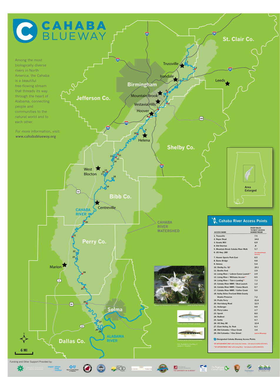
skip to main content
UA CENTER FOR ECONOMIC DEVELOPMENT
  • Home
    • About
    • Contact Us
    • Staff >
      • Sally Brown
      • Erin Hackenmueller
      • Candace Johnson
      • Arturo S. Menefee, Ph.D.
      • Nisa Miranda
      • Brian Rushing
      • Martha Whitson
  • Programs
    • Alabama Birding Trails
    • Alabama Indigenous Mound Trail
    • Alabama Communities of Excellence
    • Leadership Development
    • Outdoor Recreation
    • Planning and Community Development
    • Tourism Development
    • Your Town Alabama
  • Projects
    • Alabama Innovation Engine
    • AmeriCorps VISTA
    • Arts, Culture and Heritage Project
    • Books for the Black Belt
    • Equitable Neighborhoods Initiative
    • Flawless Delivery
    • I-22 Corridor Strategic Development
    • Landmark Projects
    • Living Legends
  • Partners
  • More...
    • Mural >
      • Submit a Mural
    • Tool Kits
  • Birding May 9

​

Cahaba Blueway

​As one of the most biologically diverse and beautiful rivers in North America, the Cahaba is a nationally significant natural resource that flows through North-Central Alabama, connecting some of the richest and poorest counties in our state.  While the Cahaba serves as a major drinking water source for several communities and is an attractive feature for residential developments to overlook, the river has been largely undervalued as an economic asset - a fact that has contributed to a deficit in how we have collectively stewarded the river.  However, the Cahaba has significant potential to become a regional and even national recreational destination that will not only enhance the quality of life for North-Central Alabama residents, but also support economic development in this region through attracting recreational tourists to paddle, float, swim, fish, and observe wildlife.  

Program Background

The Cahaba Blueway initiative of The University of Alabama Center for Economic Development (UACED) has been designed to remove the informational and physical barriers that currently prevent people from experiencing the Cahaba, and create a program that will draw people to the river from near and far. The Cahaba Blueway will not only improve quality of life in nearby communi‐ ties by enhancing access to green space, but it will provide expanded opportunities for hospitality and retail business, as we have seen in towns along similar “water trails.” Sustainably developing the Cahaba for recreational access increases the river’s value as an economic asset, and we believe this effect, combined with an increasing number of people who come to know and appreciate the river, will also lead to better conservation outcomes for this outstanding natural resource.

Program Development

​Working with multiple public and private partner organizations and with input from the public, we have developed a brand for the Cahaba Blueway and guidelines for standardized signage that communities can use when developing their own access points along the river. The brand is recognizable and the signs standards provide important and easy‐to‐understand location and safety information enabling visitors to have an enjoyable experience. We have also developed guidelines for the design, construction, and operation of river access infrastructure, which communities can use to develop access points that are safe, environmentally sustainable, and durable. We have facilitated two pilot projects at the Grants Mill Access in Irondale and at the Williams Access at the Living River Retreat that demonstrate the successful application of these practices.  As UACED has developed the programmatic resources, we have been conducting outreach in communities up and down the river to educate local leadership about the initiative and to establish steering committees that will inform the implementation of the Cahaba Blueway system in each city and county.

Inaugurating the Blueway

Through the program development process, we have identified a total of 30 prospective Cahaba Blueway access sites from Trussville to Old Cahawba, and all of these lie within lands that are currently publicly accessible. Fifteen of these sites have sufficient infrastructure to be designated as a Cahaba Blueway access points as part of our official inauguration of the water trail in April of 2019.  In addition to the Cahaba Blueway wayfinding signage at these locations, UACED has developed a website at cahabablueway.org that provides important information about how to access and stay safe the river as well as connecting visitors to local tourism resources, hospitality providers, and equipment suppliers and outfitters.

Moving Forward

​UACED is conducting ongoing community development with program partners and local steering committees to strengthen the connection between citizens and tourists with the river and to help support visitor patronage at local businesses.  Where needed, UACED and its program partners will provide technical assistance to communities seeking to make river access infrastructure improvements and connect to the Cahaba Blueway.
Cahaba Blueway map showing counties, river, access points

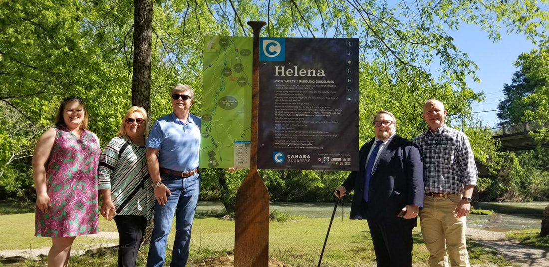
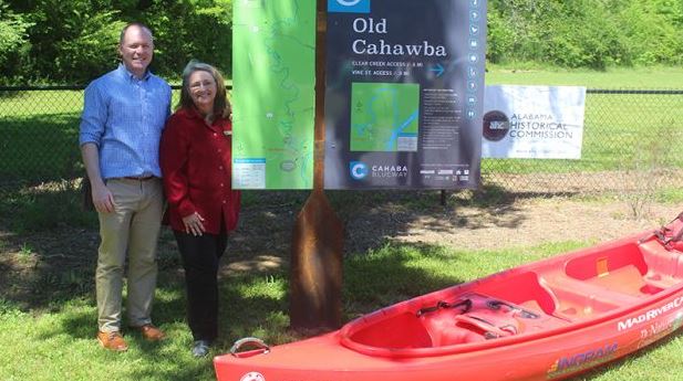
Signage Dedications April 2019

Six people standing next to upright sign Cahaba River National Wildlife Refuge
Cahaba River National Wildlife Refuge, photo by David Butler
People standing next to up right sign Cahaba Blueway Grants Mill
Grants Mills, photo by David Butler
Group of people standing next to upright sign Cahaba Blueway Perry Lakes
Perry Lakes, photo by David Butler
People standing by upright sign Cahaba Blueway Living River Access
Living River Williams Access, photo by Candace Johnson
People standing by upright sign Cahaba Blueway Helena
Helena Amphitheater Park, photo by David Butler
People standing by upright sign Cahaba Blueway Old Cahawba
Old Cahawba Archaeological Park, photo by Carmen Yelle
Upright sign next to picnic table river in background Mountain Cahaba Riverwalk
Mountain Brook Cahaba Riverwalk
People standing next to upright sign Cahaba Blueway Trussville Greeway
Trussville Greenway, photo by Maura Davies

Outline of man in gray next to upright signage with boat paddle in the middle
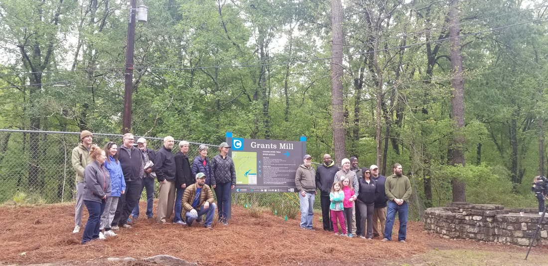
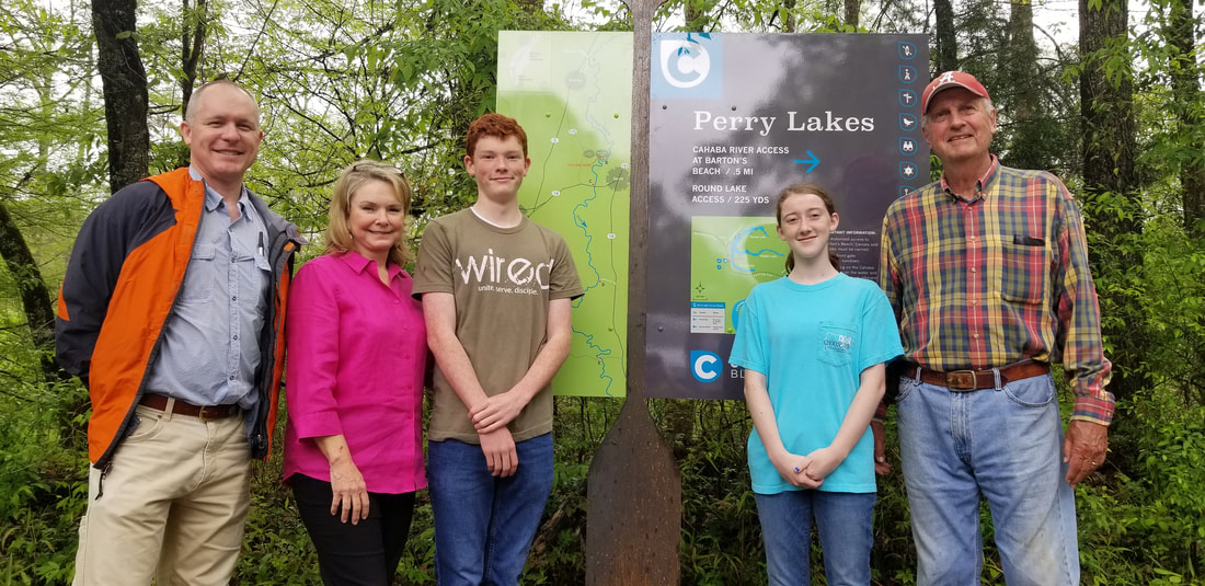
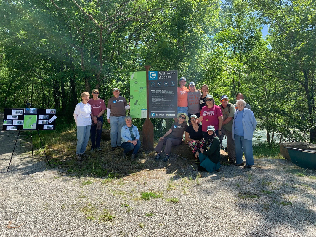
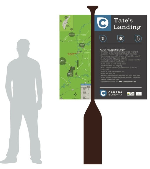
Example Wayfinding Sign
Video by Hunter Nicols
ABOUT

ALABAMA BIRDING TRAILS
​

ALABAMA COMMUNITIES OF EXCELLENCE

ALABAMA INNOVATION ENGINE

​
AMERICORPS VISTA

ARTS, CULTURE AND HERITAGE
​
​BOOKS FOR THE BLACK BELT

​CONTACT ​​

LANDMARK

LIVING LEGENDS

OUTDOOR RECREATION PLANNING AND DEVELOPMENT

PLANNING AND COMMUNITY DEVELOPMENT

STAFF

THE UNIVERSITY OF ALABAMA

TOOL KITS

​
TOURISM DEVELOPMENT

YOUR TOWN ALABAMA


The University of Alabama 
Center for Economic Development -
Box 870138
Tuscaloosa, AL  35487
​621 Greensboro Avenue
Tuscaloosa, AL 35401
Phone - 205.348.7058
Fax - 205.348.6974
email - uced@ua.edu
Picture
Picture
 The University of Alabama 254 Rose Administration Box 870114 Tuscaloosa, AL 35487-0114 (205) 348-4890 © Copyright 2020 All Rights Reserved